The role of the bridge in flood management
The bridge sits atop culverts (which work as piers for the bridge) that allow water to flow along Cottage Creek under Hunter Street. The buildings that were previously located on the southern side of the bridge prevented any overland flow of water over Hunter Street during large flood events.
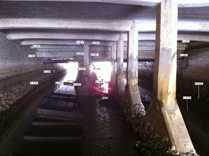
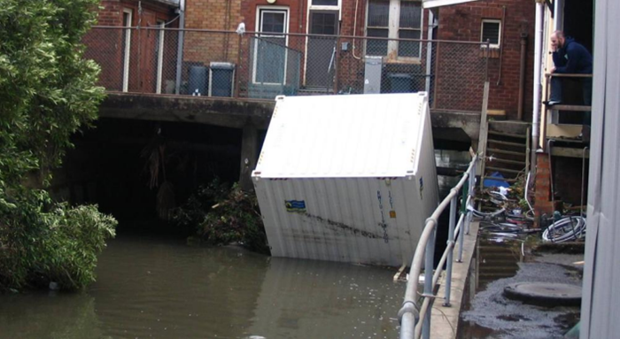
In storm events, culverts can become blocked by debris. In the 2007 Pasha Bulker storm, a shipping container became wedged against the culvert, blocking the flow of water and significantly increasing flood levels upsteam (toward Marketown).
Flood modelling undertaken to inform the Newcastle Floodplain Risk Management Study and Plan (2012) determined that a blockage in the lower reaches of Cottage Creek exacerbates flooding throughout the Marketown commercial precinct (by about 0.5 metres or more) during a 1% AEP flood event (there is a 1 in 100 chance that a flood of this size or bigger will occur in any year – the June 2007 Pasha Bulker event was about this big for many areas of Newcastle).
Demolition of the buildings on the southern side of the bridge in 2019 provided an alternative overland flowpath for water. The proposed design for the replacement of the bridge would be a single span bridge which would further improve the flow of water during storm events, and reduce the risk of blocking, as the current structure has offset middle piers which reduces flow volume under the bridge.